View Başarsoft Solution Partners
Quality Certificates
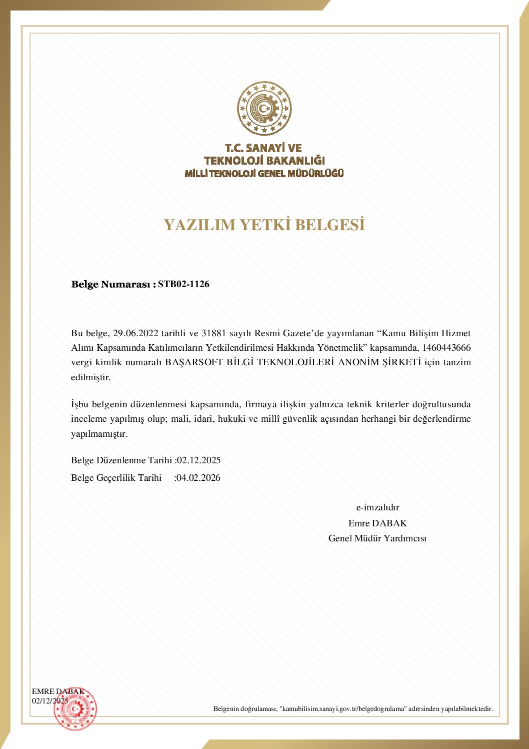
- Software Authorization Certificate
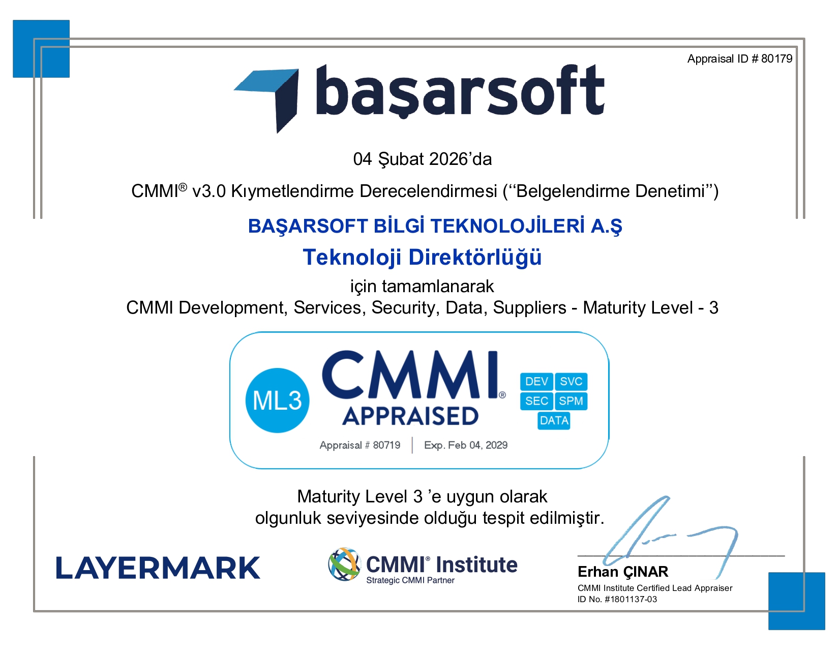
- CMMI ML3
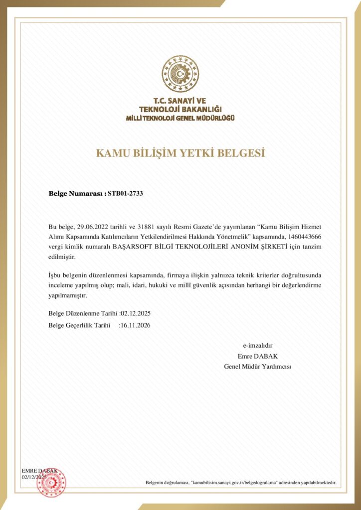
- Public Informatics Authorization Certificate
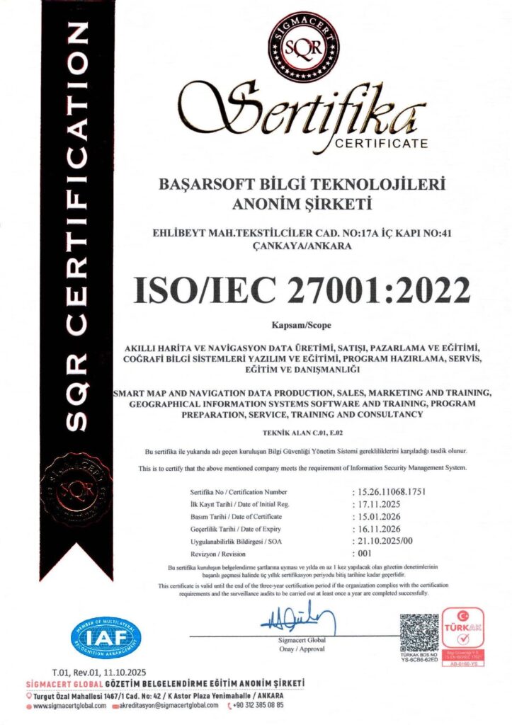
- ISO/IEC 27001:2022 Information Security Management System
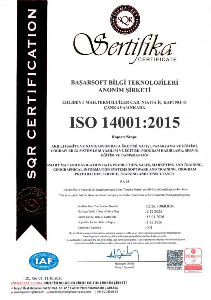
- ISO 14001:2015 Environmental Management System
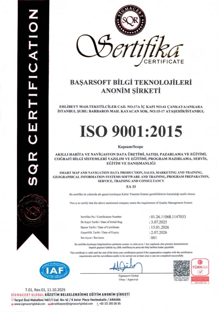
- ISO 9001:2015 Quality Management System
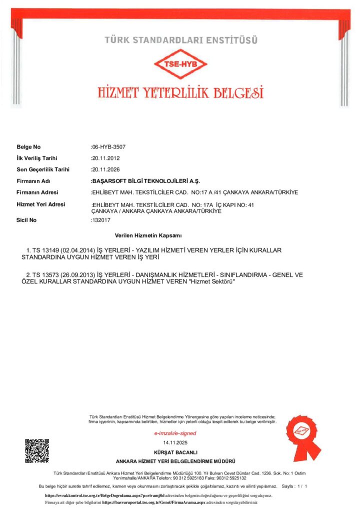
- Service Qualification Certificate
- Service Export Certificate (Software & IT)
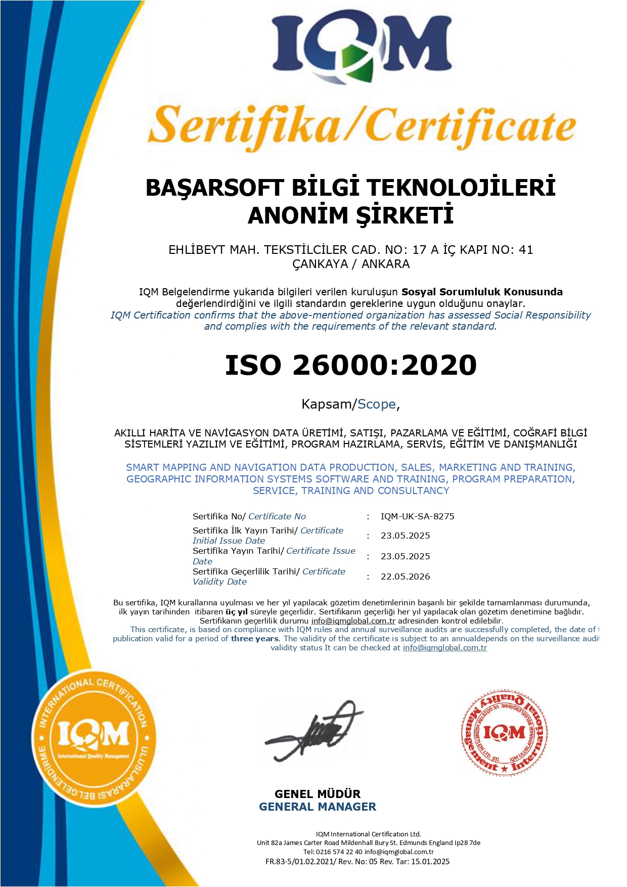
- ISO 26000:2020 Social Responsibility
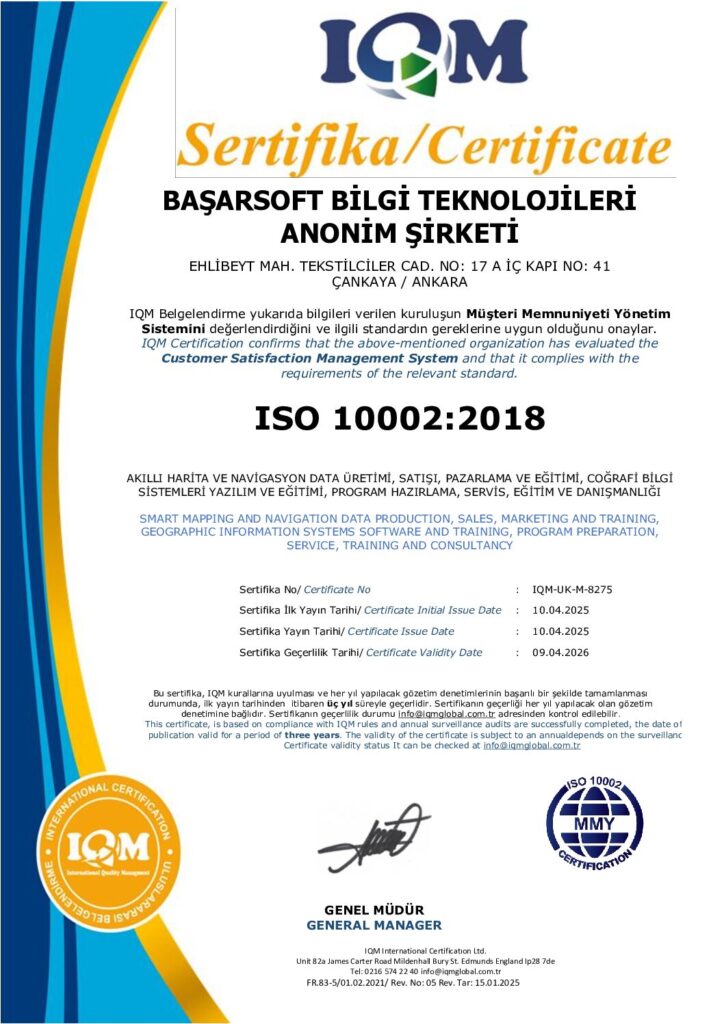
- ISO 10002:2018 Customer Satisfaction Management System
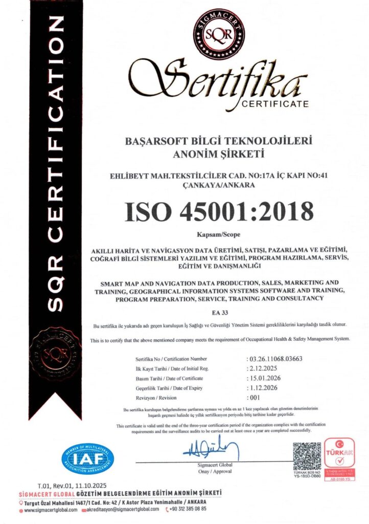
- ISO 45001:2018 Occupational Health and Safety Management System
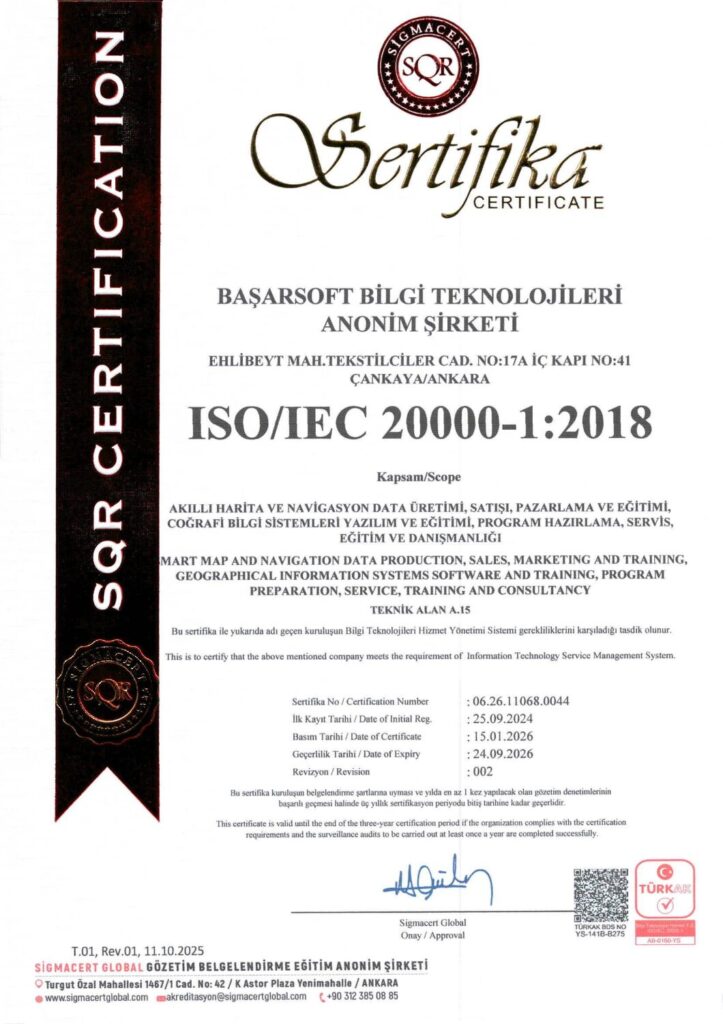
- ISO 20000-1 Information Technology Service Management System
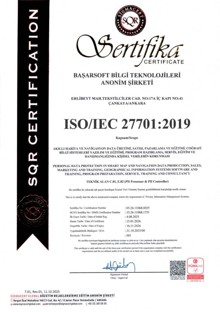
- ISO 27701 Personal Data Management System
- Patent Certificate Traffic Density Prediction System
- Patent Certificate Vehicle Routing and Optimization System
- Basarsoft Geocoder
- Asukayip
